MIDDLE AND SOUTH AMERICA
Countries Present in this Region: 28
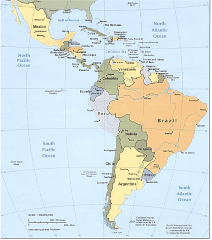
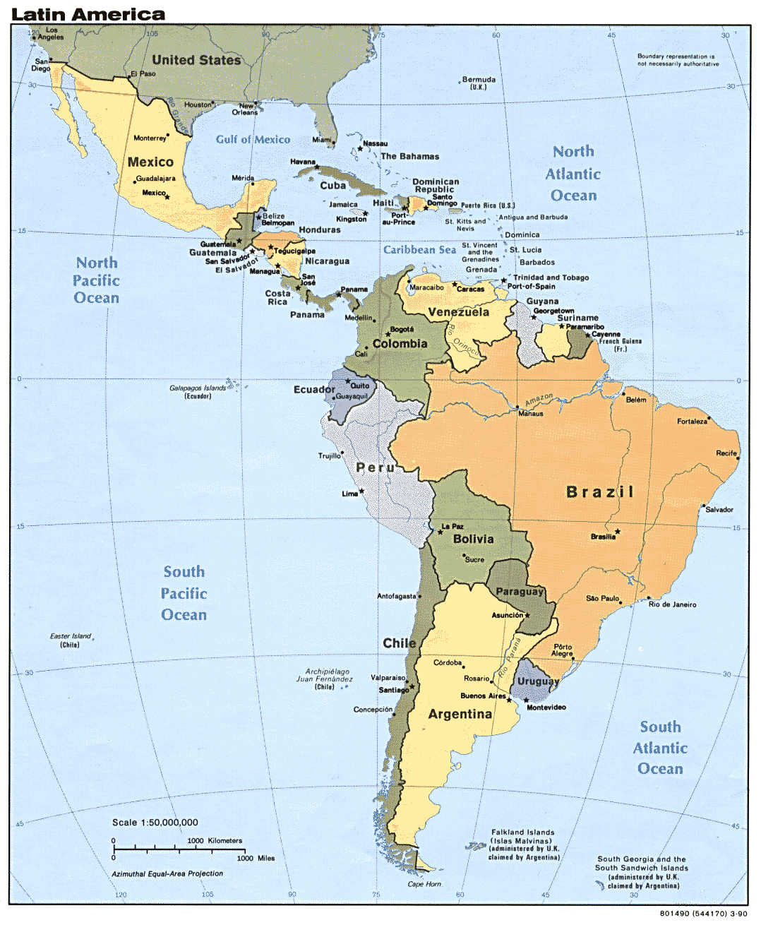
Mexico, Guatemala, Belize, El Salvador, Honduras, Nicaragua, Costa Rica, Panama, Jamaica, Cuba, Bahamas, Haiti, Dominican Public, Puerto Rico, Barbados, Trinidad & Tobago, Colombia, Ecuador, Peru, Chile, Bolivia, Argentina, Uruguay, Paraguay, Brazil, Suriname, Guyana, Venezuela
Physical Features:
Along the western coast of South America, and into Middle America, one will find a 4,500 mile mountain system, the Andes Mountains, extending from Panama all the way down to the southernmost tip of South America. This mountain range is one of the longest found on Earth. This mountain system has tooth like edges, and has many peaks reaching over 20,000 feet in elevation. Aconcagua, its largest peak, is 22,384 feet in elevation. Many of its peaks are actually active volcanoes, and are some of the largest volcanoes on the planet. Because this is a long, continuous chain of mountains, it is a barrier between the eastern Pacific Ocean and South America, affecting the climate. The northern part of the Andes is generally rainy and warm. The western side of the central Andes is very dry, which includes the Atacama Desert. On the other hand, the eastern portion of the central Andes is much wetter, along with the southern Andes. Many of these peaks receive lots of snow, and contain glaciers. Plate tectonic forces, the Nazca plate and part of the Antarctic plate, are responsible for forming this mountain range. The Andes Mountains are the source of major rivers found in South America. If one is looking to go climbing, mountaineering, backpacking, or trekking, this is a place you would love to check out!
The Amazon Basin is an approximately 2.72 million square foot basin located primarily in Brazil, but also lies in its western neighboring countries such as Colombia, Peru, and Bolivia. It covers almost a third of South Africa. It is drained by the Amazon River and more than 1,000 of its tributaries; seven of these tributaries are longer than 1,000 miles. This basin is covered by the world’s largest rainforest, containing almost one-fifth of the earth’s fresh water, and more than 100,000 plant and animal species (Pulsipher & Pulsipher, 2008). It has a tropical rainforest climate, having measurable rainfall at least 200/365 days, reaching a total rainfall of over 8 feet a year. In many areas, parts of the forest have been cleared or soy bean plantations and ranching; some inhabitants harvest wild rubber latex and Brazilian nuts. A tropical fruit tree, the abiu, is native to the Amazon Basin. This tree can grow as high as 116 feet, and the fruit’s shape can vary from round to oval. It has a creamy, jelly-like texture, and tastes as sweet as caramel.
One of the longest rivers in the world, and the largest in South America, is known as the Amazon River. This river ranges from 3,903 to 4,195 miles long, starting high, as streams, in the Andes Mountains. Once the streams meet up and become rivers, they flow east towards the Atlantic Ocean. The widest point of the river, during the dry season, can reach 6.8 miles. During the rainy season, the width can almost triple, reaching 24.8 miles wide. The mouth of the river can open up to 202 miles wide as it empties into the Atlantic Ocean. This river carries approximately 20 percent of all freshwater to the ocean as it drains the northern half of South America. Once the rivers reach flatter land in the Amazon Plain and its velocity slows, silt (fine soil particles) sink to the bottom of the river. When the rivers flood in the rainy season, it renews and nourishes millions of acres of soil in areas of the tropical rainforest (Pulsipher & Pulsipher, 2008). The largest freshwater fish, the Arapaima, also known as the Pirarucu, is found in this river. They can reach up to 15 feet in length and weigh up to 440 pounds. The river is also home to the biggest snake, the Anaconda, and the most ferocious, Piranha.
A long and skinny desert, the Atacama Desert, is found in the northern west coast of Chile. It extends nearly 625 miles from north to south. The average width is approximately 100 miles, running east from the Pacific Ocean to the Andes Mountains. It is a cold, but very dry area; it is one of the few coastal deserts that don’t receive any rainfall. Some areas of this desert have never had any recorded rain. It is composed mostly of salt basins, sand, and lava flows towards the Andes Mountains. Its landscape is very barren, almost lacking. Small borax leaves cover some of the landscape; remnants from lava flow and saline deposits cover the other portion. Few animal species have inhabited this area due to it being extremely arid; insects are absent, and even bacteria are scarce. Some areas of this desert, however, do receive Camanchaca (a marine fog) that provides enough moisture for some algae, lichens, and some cacti to grow. It has the world’s largest supply of sodium nitrate, mining in large scale until the early 1940s. There was a border dispute over this resource, along with the rich deposits of copper and other materials, between Chile and Bolivia that began in the 19th century. Because of this, there are about 170 abandoned nitrate mining towns throughout the desert.
Stretching across the northern part of South America is a fertile plain and grassland known as the Llanos. It covers approximately 220,000 square miles, occupying the west side of Venezuela and northeastern Colombia. It is drained by Orinoco River’s western tributaries and the Orinoco River itself. Precipitation in this area is concentrated between the months of April and November; it varies from 45 inches in the central plains to 180 inches near the Andes Mountains. The average temperatures usually exceed 75°F. Deer, rabbits, anteaters, armadillos, jaguar, along with the world’s largest living rodent, the capybara, nest in the gallery forests and feed on these grasslands. The raising of cattle and small farming is a huge part of this area’s economy.
Climate:
Many factors in this region influence the wide variety of climates. First off, the landmasses span a great distance on both sides of the equator (Pulsipher & Pulsipher, 2008). Secondly, the long mountain chain creates changes in altitude contributing to the variety of temperatures. Lastly, the wind and ocean currents affect precipitation patterns (Pulsipher & Pulsipher, 2008). There are four temperature-altitude zones found in this region. Generally, a rise in the altitude causes the air temperature to decrease by about 1°F for every 300 feet of elevation (Pulsipher & Pulsipher, 2008). The first temperature-altitude zone is known as the tierra caliente. This is generally found in the lowlands, as temperatures are generally the warmest. This altitude zone can reach up to 3,000 feet in elevation. The second, tierra templada, is cooler, with a year round spring at elevations from 3,000-6,500 feet. The third, tierra fria, are the cool lands between 6,500-12,000 feet. And lastly, the tierra helada is generally cold, reaching elevations about 12,000 feet. So in general, the higher you go, the colder it’s going to get; the lower elevation you go, the warmer it’s going to be. Various precipitation amounts throughout the region are influenced by global and wind patterns, elevations such as mountains, and ocean currents. The tropical winds blowing from the northeast and southeast to the equator, blow off of the Atlantic Ocean and bring heavy seasonal rainfall (Pulsipher & Pulsipher, 2008). Winds from the Pacific Ocean bring seasonal rain to Central America’s west coast, however, the mountains block rain from the Caribbean side (Pulsipher & Pulsipher, 2008). The El Niño changes the direction of the Peru Current every few years, affecting South America’s west coast; warm water and enormous rainfall, instead of cold water and no precipitation is found. This warm water flows east from the western Pacific Ocean. Tropical storms, with low pressures and high wind speeds, are formed yearly near Africa in the Atlantic Ocean. If wind speeds reach over 75 MPH in a storm, they are known as hurricanes. These hurricanes can damage both human territories and crops; they cause flooding and significant wind damage.
Resources:
Many nations desire to have the resources that Brazil has available for development. Since the colonial days, such resources as gold, silver, and precious gems have been important. The most valuable resources today, however, are more industrial-like materials found in the Brazilian Highlands. These include such things as titanium, manganese, and iron ore. Most of South America is relatively rich in their mineral resources; however, Uruguay and Paraguay lack any mineral wealth. South America relies on mining, fishing and forestry, and agriculture for their economy. Venezuela has the opportunity to become one of the wealthiest countries in South America because of its large oil deposits (Pulsipher & Pulsipher, 2008). In the mid twentieth century, oil became an enormous part of the country’s economy. Venezuela supplies oil to the United States, Canada, Cuba, and the rest of South America. As of 2002, Venezuela had the capacity to produce about two million barrels of oil per day. More than half of their reserves are heavy or extra-heavy oil; they are working on processing heavy crude into more marketable products. In Colombia, round woods are produced and exported. Soft tropical woods are suitable for plywood production, paper pulp, and for manufacturing furniture. Argentina possesses four-fifths of the world’s supply of the red quebracho tree. This tree contains tannin, the extract used for tanning. Argentina also produces round wood.
Environmental Issues:
In this region, there are three major environmental issues that are affecting the quality of life for the people. These include air pollution, water pollution, and soil degradation. The main sources of pollution come from transportation, fuel, construction sites, and refineries. Cities in Colombia, Chile, Brazil, and Mexico have the highest levels of air pollution in the region. The urbanization and population growth has a negative impact on the environment; as demand grows, there is a higher need for more transportation which leads to inhabitants driving more cars. Mexico City is especially congested due to all of the cars throughout the large industrial area. The use of urban transportation is very harmful because of all the contaminates and chemicals it contains; exposure of certain chemicals leads to illness. Water pollution affects many countries in this region; Buenos Aires and Caracas are large cities affected by the poor water supply as the Water pollution affects many countries in this region; Buenos Aires and Caracas are large cities affected by the poor water supply as the depend on large wells. Solid waste management in some areas is inefficient leading to water contamination and pollution. In Guatemala, Nicaragua, and El Salvador, mining has led to pollution and has diverted rivers. The transportation of radioactive materials through the Panama Canal has contaminated the Canal. Poor water supplies can be caused by the unregulated industrialization, urban poverty, and poor farming. In general, the smaller the city, the more severe the problems and pollution. This region is also being affected by soil erosion and soil pollution. Soil erosion is occurring rapidly as farmers are growing crops that are unnatural to the habitat; soybean cultivation in Brazil and Argentina is an example. As a result of this, the cultivation has left many areas unusable. The use of pesticides causes chemical soil pollution, which in turn causes degradation of soil.
Population Patterns:
About 14,000+ years ago, many native people migrated to Middle and South America, crossing what is known as the Bering land bridge. There were around 50-100 million indigenous people by 1492, making densities in rural populations high (Pulsipher & Pulsipher, 2008). At this time, the Incas had the largest state, stretching from southern Colombia to the northern part of Chile and Argentina; majority of the population was in the Andes highlands. In Middle and South America, the European Conquest killed millions of indigenous people by slavery and cruelty, and changed landscapes and cultures (Pulsipher & Pulsipher, 2008). Europeans conquered many major population centers; they carried diseases that indigenous people were susceptible to. Because of this, within 150 years, the diseases killed off almost 90% of the population. In the early 1500s, African slaves replaced the indecorous people’s labor; the Portuguese were important suppliers. In the twentieth century, development increased; however, there is still underdevelopment and unequal wealth distribution despite the regions human and natural resources. Today, at least 30% of the population is poor, lacking food, shelter, land access, and education (Pulsipher & Pulsipher, 2008). As of 2005, there is close to ten times the population than in 1492; about 560 million people were living in this region. There are 230 million more people living in this region, that that of North America (Pulsipher & Pulsipher, 2008). The population distribution is unequal; there are high concentrations of people in highlands such as Mexico City and Colombia, and lowland zones along the Pacific coast in Central America. The tierra templada temperature-altitude zone is pleasant to live in, along with tierra caliente near the sea side. This seaside living is attractive because of the ocean water modifying the temperatures. This region has a high rate of natural increase; by the 1980’s families were limiting their family sizes resulting in falling population growth rates. More than 75% of the region’s population live in towns of at least 2,000 people; since the 1970’s, migration has been high from rural areas to urban communities (Pulsipher & Pulsipher, 2008).
Role of Gender:
This region’s family roles are that of the extended family. It is accepted that an individual should put their interests towards their family and local community; this secures individual well-being (Pulsipher & Pulsipher, 2008). Several generations live together, including the adult’s siblings, their significant others, their children, and also the parent’s of the adults. Female relatives are the women’s friends, and the man’s social life usually includes the male relatives or family friends. The Catholic Church influences the daily life of women and encourages them to use the model of the Virgin Mary. This model contains values such as including abstaining from sexual relations, priority of motherhood, and also family service. The women manage the house and the family. They train their sons to explore the world, and their daughters to stay around in the home. In other words, the women are usually housewives. If they go out and seek employment outside of the home, they gain personal independence. Men, on the other hand, are expected to work and are the source of income for the family. Men have more personal independence and freedom in their life than women; they have more independence to talk and associate with the opposite sex. The model of machismo is what males measure themselves by; this measures manliness in such ways as honor, respectability, father-like measures, attractiveness to women, and the household master (Pulsipher & Pulsipher, 2008).
Religions:
There are two main religious groups in Middle and South America. Roman Catholicism in the most influential in this region; Catholicism has dominated this region. Evangelical Protestantism is the fastest growing religion; about 50 million people follow it, which is about 10 percent of the region’s population. In the colonial era, Roman Catholicism was partnered with the Spanish and Portuguese governments in which it received land and resources; it also sent missionary priests to convert the native people. This religion encouraged working people to: accept that they were low status, comply with authorities, and hold their rewards until after death in heaven. The church reinforced differences in classes and worked to unify the region and expand the European culture. Native people put their ethnicity into Catholicism creating different versions of the religion with music and Scripture interpretations that were different than the European one. Populist movements changed around the church’s land distribution and lowered the expensive fees for baptisms, weddings, and funerals. Today, they focus more on both poor people, and people that are not European, instead of the “best” group. Evangelical Protestants appeal more to people that are in need, the rural and/or urban poor; the poor and middle class tend to follow this religion. This religion teaches the “gospel of success” in which one will experience wealth of the body and soul if they are a true believer of Christ (Pulsipher & Pulsipher, 2008). It focuses more on the personal level rather than the social change; because of this, it benefits all citizens.
Judaism, Islam, Hinduism, and native beliefs are also found across the region (Pulsipher & Pulsipher, 2008). Wherever the descendants of Africans settled, African-based belief systems with some Christian beliefs, such as Voodoo are found. These attracted European and native backgrounds, especially in urban areas (Pulsipher & Pulsipher, 2008).
Transportation:
The main way of transportation in this region is by roads. In developed countries, the roads are paved and well kept; in poorer countries, the roads are in bad condition and unpaved. City transport, such as bus systems and taxis, are popular for tourism. Taxis tend to provide safe and convenient travels and are usually inexpensive. Long distance buses are used for traveling on extended journeys; however, there can by long delays and can be disorganized. In South America, Argentina has the largest railway system; as of 2002, there was 20,978 miles of railway (“Argentina,” 2011). Railroad deterioration has increased the demand for road transportation. By 2001, there was 133,871 miles of roads in which only about 40,000 miles were paved. This road system in Argentina is not adequate, especially for their rapidly growing automotive industry. The main river systems of Argentina total about 6,800 miles of navigable waterways; these promote efficient water transportation. The most important air terminal in South America is Buenos Aires. In 1997, civil aviation services flew just about 77 freight tons per mile and carried 5.7 million passengers on both in-region and international flights (“Argentina,” 2011).
Agriculture:
Plants from the Old World are still essential to agriculture today in this region. These plants include, but are not limited to: rice, sugarcane, citrus, melon, banana, onion, apple, wheat, barley, and oats (Pulsipher & Pulsipher, 2008). Agricultural products vary from fruits and veggies to dairy items, to meat and livestock, to fish. Beef raising in Argentina, Uruguay, Paraguay, and Colombia is important for export to other countries. Coffee is the most important topical crop grown for both in-region use and for export; it is produced in the Brazilian Highlands and in central and western Colombia. Peru, Guyana, and Suriname produce sugar for export; sugarcane in other parts of the region is for in-region use only. Because of the different temperature-altitude zones in this region, different plants grow better in different areas. In the tierra caliente, tropical plants such as bananas, sugarcane, cacao, and pineapples do well if there is enough moisture. In the tierra templada, crops such as corn, beans, various green veggies, wheat, and coffee are grown. In the tierra fria, or the cool lands, midaltitude crops such as fruit trees and root veggies (potatoes, onions, etc) are grown, along with cool-weather veggies (cabbage and broccoli) (Pulsipher & Pulsipher, 2008). In the tierra helada, llamas, sheep, and guinea prigs are raised for food and fiber, and cultivation of many grains and root veggies takes place. Vegetation in high altitudes is absent.
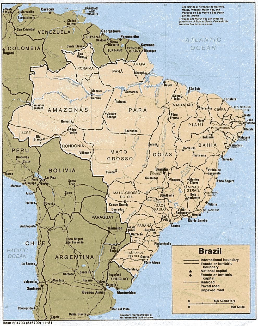
Country of Focus: Brazil
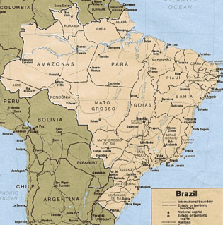
Brazil is located on the east central side of South America. It is the largest country in South America; it covers approximately half of the continent totaling 3.29 million square miles. There are 184 million people occupying this country; the society is made up of a wealthy class, middle class, and poverty line class. The majority of people live below, or barely above, the poverty line. In Sao Paulo and Rio de Janeiro, one may find high crime rates and homeless street children; this is an example of the inequities in both opportunity and well-being. The climate varies throughout the region. In the northern part, the Amazon Basin is typically a hot, tropical climate. The Brazilian Highlands, on the east coast, have a subtropical climate. In the upland plains in the south, one can expect a temperate climate and occasional snowfall. From May to September, it is generally cool temperatures; December to March is generally the warmest. Roads are the main type of transport for both freight and passenger traffic. As of 2002, there are 114,425 miles of paved roads. The bulk of highway traffic in concentrated into the southern and central areas of Brazil. Air transportation is highly developed; there was an estimated 3,365 airports in 2001. Brazil has the largest economy in the Middle and South America region, and is the eighth largest in the world (Pulsipher & Pulsipher, 2008). The minerals valuable today are found in the Brazilian Highlands; these include titanium, iron ore, manganese, etc. Sixty percent of Brazil’s needs are provided by local oil (Pulsipher & Pulsipher, 2008). A large portion of the remainder of the energy needs is supplied by ethanol. Health and sanitary conditions vary throughout the region. Generally, the large cities have competent physicians, generally with advanced training. However, in the interior towns, there is a lack of doctors, nurses, and even hospitals. Brazil has a high infant mortality rate, but has decreased in the last fifteen years; in 2000, the infant mortality rate was 32:1,000 life births. The average life expectancy is 68 years.
References:
Agriculture, forestry and fishing in south America- continent profile. (Modified 2011, Feb. 13)Retrieved from http://www.mbendi.com/indy/agff/sa/p0005.htm#10
Argentina – transportation (2011). Encyclopedia of the Nations. Retrieved from http://www.nationsencyclopedia.com/Americas/Argentina-TRANSPORTATION.html
Atacama desert. (2007, Apr 18).The Encyclopedia of Earth. Retrieved from http://www.eoearth.org/article/Atacama_desert
Brazil overview (2011). Encyclopedia of the Nations. Retrieved from http://www.nationsencyclopedia.com/Americas/Brazil.html
Environmental problems in latin america. (2007, Apr 26). Retrieved from http://www.associatedcontent.com/article/217084/environmental_problems_in_latin_america_pg3.html?cat=7
Landforms of south america. (n.d.). World Atlas. Retrieved from http://www.worldatlas.com/webimage/countrys/saland.htm
Pulsipher, L.M., & Pulsipher, A. (2008). World regional geography: global patterns, local lives (4th ed.).
New York, NY: W.H. Freeman and Company.
The amazon river. (2011). Extreme Science. Retrieved from http://www.extremescience.com/zoom/index.php/earth-records/3-greatest-river
The University of Texas at Austin. (Modified 2011, Feb 20). University of Texas Libraries: Perry-Castaneda Library Map Collection. Retrieved from http://www.lib.utexas.edu/maps/americas/latin_america.gif
The University of Texas at Austin. (Modified 2011, Feb 20). University of Texas Libraries: Perry-Castaneda Library Map Collection. Retrieved from http://www.lib.utexas.edu/maps/americas/brazil_pol_1981.gif
