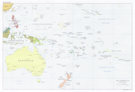
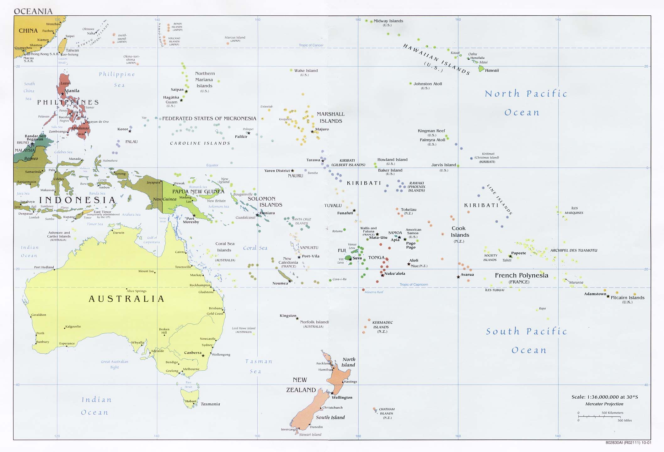
OCEANIA: AUSTRALIA, NEW ZEALAND & THE PACIFIC
Countries Present in this Region: 13
Australia, New Zealand, Vanuatu, Papua New Guinea, Palau, Federated States of Micronesia, Marshall Islands, Nauru, Kiribati, Solomon Islands, Fiji, Tonga, Samoa
Physical Features:
The Great Dividing Range runs parallel along the eastern and southeastern coast of Australia and extends into Tasmania (“Australia Landforms”). These mountains and the varied ranges separate the dry interior from the coastal areas. The highest point, Mt. Kosciusko in the Australian Alps, is 7,310 feet in elevation (“Australia Landforms”). This mountain range is the most extensive in Australia and stretches more than 2,175 miles from the northeastern tip of Queensland to western Victoria (“Great Dividing Range,” 2008). Vegetation varies throughout the length of the range; rainforests provide homes and shelters to various wildlife (“Great Dividing Range,” 2008). This range is important for the tourist industry with its various mountain ranges, national parks, and skiing.
The Great Barrier Reef lies off the northeastern coast of Australia and stretches is an “irregular arc for more than 1,250 miles along the coast of Queensland” (Pulsipher & Pulsipher, 2008). It covers approximately 135,000 square miles; it is not one continuous reef as it is comprised of 2,800 individual coral reefs and different coral cays (“Australia Landforms”). It is the world’s longest and largest deposit of coral reef (“Pulsipher & Pulsipher, 2008). The Great Barrier Reef became a World Heritage Site in 1981 for its beauty and wildlife; there are 1,500 fish species alone (“Australia Landforms”). This giant reef warms Australia’s southeastern coast as it “interrupts the westward flowing ocean currents in the mid-South Pacific circulation patterns, shunting warm water to the south” (Pulsipher & Pulsipher, 2008).
Running along the western side of New Zealand’s South Island, the Southern Alps extend 400 miles north to south (Przyborski, 2008). These rugged mountains are often concealed by clouds; this could be why the Maoris called New Zealand Aoteaoa, or the long white cloud. The highest peaks are continuously snow-covered and the climate is cold and icy year round. The westward blowing winds bring clouds that drop over 195 inches of rain yearly on the west coast’s rain forest (Przyborski, 2008). The tallest mountain, Mt. Cook, has an elevation of 12,287 (Przyborski, 2008). From the high peaks, glaciers have gouged long, slender mountain lakes and valleys along the mountain range (Przyborski, 2008).
The Great Artesian Basin is located near Queensland in eastern Australia. It is one of the world’s largest areas of artesian water, covering approximately 670,000 square miles (“Great Artesian Basin,” 2011). It underlies almost one-fifth of Australia, with segments underlying Queensland, New South Wales, South Australia, and Northern Territory (“Great Artesian Basin,” 2011). The floor depths vary considerably, with bores in Queensland averaging approximately 1,600 feet (“Great Artesian Basin,” 2011). The daily free discharge of water averages about 350 million gallons of water (“Great Artesian Basin,” 2011).
The Gulf of Carpentaria is enclosed on the west by Arnhem Land and on the east by the Cape York Peninsula; it indents the northern coast of Australia (“Gulf of Carpentaria,” 2011). This shallow, rectangular inlet of the Arafura Sea has an area of 120,000 square miles and a deepest point of 230 feet (“Gulf of Carpentaria,” 2011). This gulf was neglected for many years until the late 20th and early 21st centuries when bauxite, manganese, and shrimp resources were exploited (“Gulf of Carpentaria,” 2011). Layers of bauxite up to 33 feet thick are on the shores of the gulf; on top of these deposits are beds of sandstone (“Gulf of Carpentaria,” 2011). The large manganese deposits located in the west of the gulf were formed along an” irregular shoreline of an ancestral gulf” (“Gulf of Carpentaria,” 2011). Because of the economic developments with the exploitation of manganese and bauxite, along with the developing prawn fishing, the settlements along the shores and islands of the gulf have increased drastically from a handful to thousands of people; transportation and communication links with the rest of Australia and the world have also increased (“Gulf of Carpentaria,” 2011).
Climate:
Most of this region falls within the tropical and subtropical latitudes of the Pacific Ocean (Pulsipher & Pulsipher, 2008). The ocean’s lukewarm water temperatures bring mild climates to the majority of the inhabited parts of the region throughout the year. The seasonal temperature variations are greatest in southern Australia and New Zealand (Pulsipher & Pulsipher, 2008). The majority of the region is warm and humid, except for the dry interior of Australia. New Zealand and the Pacific high islands receive a large amount of rainfall. The roaring forties, “powerful air and ocean currents that speed around the far Southern Hemisphere virtually unimpeded by landmasses” is a mass of moisture that travelers might see as a long, white cloud (Pulsipher & Pulsipher, 2008). Winds blowing west to east bring New Zealand 130 inches of rain per year and the coastal lowlands more than 30 inches (Pulsipher & Pulsipher, 2008). New Zealand’s North Island has winds up to 40mph for almost a third of the year on the southernmost tip. Almost 2/3 of Australia is very dry. Because the Great Diving Range blocks the winds blowing east to west, the interior doesn’t receive the rain; much of Australia receives 20 inches or less of rain per year (Pulsipher & Pulsipher, 2008). The eastern slopes o the highlands receive more moisture. Many of the high, mountainous islands of the Pacific have orographic rainfall patterns. This means there is a “wet windward side and a dry leeward side” (Pulsipher & Pulsipher, 2008). The lower islands receive variable amounts of rainfall; if on the path of trade winds, 60 to 120 inches of rain may be received (Pulsipher & Pulsipher, 2008). Islands on the equator receive much less rainfall. The El Nino phenomenon happens every 2-7 years; this is when circulation of air and water in the Pacific changes patterns. Recently, a different pattern of the normal conditions becoming unusually strong occurred and it was named La Nina (Pulsipher & Pulsipher, 2008).
Resources:
Throughout the region, there are a variety of natural resources. Australia continues to be the world’s third-largest producer of metals and minerals. It has the world’s largest resources of lead, mineral sands, nickel, silver, uranium, and zinc. They ranked in the top six for black and brown coal, copper, gems, gold, iron ore, lithium, and manganese ore (“Asia and Oceania,” 2011). They are self-sufficient in mineral commodities as they produce more than 60 minerals and metals commercially (“Asia and Oceania,” 2011). They are the world’s leading exporter of bauxite, coal, diamond, and iron ore (“Asia and Oceania,” 2011). Australia also has a substantial portion of the world’s mineral sand resources. Papua New Guinea has a leading industry of gold, silver, and copper mining; in 2000, this mining contributed 17.1% of the GDP (“Asia and Oceania,” 2011). Crude oil production and construction are other leading industries. Oil, gold, and copper ore ranked as the top three export commodities in 2002 (“Asia and Oceania,” 2011). Supplying 70% of export earnings in 200, mining and petroleum also employed 2% of the workforce (“Asia and Oceania,” 2011). Mineral exploration is being expanded; lead, manganese, zinc, limestone, rock deposits, and deposits of chromite, cobalt, and nickel are found within Papua New Guinea (“Asia and Oceania,” 2011). In the early 19th century, gold was discovered in New Zealand when the European sealers and whalers were exploring the country. Gold deposits were discovered on the South Island in 1861; by 1870, copper, iron, lead, and silver deposits were discovered (“Asia and Oceania,” 2011). New Zealand has a variety of potentially profitable mineral deposits; few of these deposits have been extensively exploited. In 2002, mining was a leading industry and gold dominated the mining sector (“Asia and Oceania,” 2011). New Zealand’s main exports are ironsand, limestone, cement, salt, sulfur, and pumice. Fiji’s mining sector contributed 3% to the GDP; this was all from gold (“Asia and Oceania,” 2011). In 2001, this was the only metallic mineral recovered in this country. In 2002, gold was the third leading export commodity; it has been mined and exported since 1933 (“Asia and Oceania,” 2011). It also has rich deposits of copper, lead, and zinc. Since the closing of the Banaba phosphate industry in 1979, there has been no mining in Kiribati (“Asia and Oceania,” 2011). In the last year of its operation, it exported 445,700 tons of phosphates (“Asia and Oceania,” 2011). Forests cover an estimated 38.4% of the islands; however, there is little useful timber (“Asia and Oceania,” 2011).
Environmental Issues:
When the Europeans settled Australia, they brought new animals and plants; this means that the Australia’s native plants and animals have been displaced or became extinct as a result of the nonnative species from the Europeans (Pulsipher & Pulsipher, 2008). Europeans/British settlers brought in rabbits as they enjoyed hunting and eating them; however, there are no natural predators in Australia so the rabbit population quickly grew. They are among the “most destructive of Australia’s introduced species” and they feed on the local plants and destroy the food supply for the native animal species (Pulsipher & Pulsipher, 2008). Australia has another environmental issue of water scarcity due to the large urban populations (Pulsipher & Pulsipher, 2008). Australia’s water consumption has rose in the past 30 years due to such things as flushing toilets, using washing machines, using more showers, and also using more water for irrigation (Pulsipher & Pulsipher, 2008). In New Zealand, the land used to be covered by 85% of midlatitude rain forest; however, when the Maori came about, they degraded the environment by forest clearing and overhunting (Pulsipher & Pulsipher, 2008). Today, only 23% of the land is covered by forests. Much of the environment has become opposed to many of its native species. More than 90% of the lowland area is occupied by ranches, farms, roads, and cities; this means that there are high extinction rates for the endemic plants and animals (Pulsipher & Pulsipher, 2008). In the Pacific Islands, resource extraction and pollution and nuclear pollution are environmental issues. Traditional ways of life have been disrupted because of the pollution from mining (Pulsipher & Pulsipher, 2008). The pollution of mine waste contaminates the rivers. The phosphate reserves that were once in the island of Nauru are now depleted due to the overboard resource extraction; the money made from the extraction was not smartly spent, so now the country is trying to avoid financial disaster (Pulsipher & Pulsipher, 2008). The other environmental issue is the radioactive pollution that comes from reactor waste and nuclear weapon tests (Pulsipher & Pulsipher, 2008). This radioactive/nuclear pollution has resulted in cancer, birth defects, miscarriages, and infertility. Independent countries is Oceania have signed treaties to ban testing of nuclear weapons and nuclear waste dumping on the islands (Pulsipher & Pulsipher, 2008). Marshall Islands is one of the countries yet to sign the treaty due to political pressure from the U.S. and Canada; because of this, the waste dumping and the nuclear weapon testing continues (Pulsipher & Pulsipher, 2008). Many countries, including France and the U.S. have explored the possibility of dumping their radioactive waste in the Marshall Islands (Pulsipher & Pulsipher, 2008).
Population Patterns:
The Aborigines migrated from Southeast Asia about 50,000 to 70,000 years ago and are Oceania’s longest-surviving inhabitants (Pulsipher & Pulsipher, 2008). The Melanesians began settling nearby areas while the Aborigines were settling Australia (Pulsipher & Pulsipher, 2008). The Melanesians spread to New Guinea and other islands nearby; they gave this area the name of Melanesia (Pulsipher & Pulsipher, 2008). Both the Aborigines and Melanesians survived mainly by hunting, fishing, and gathering; agriculture was practiced in the New Guinea highlands (Pulsipher & Pulsipher, 2008). In the New Guinea highlands, “agricultural features excavated in the terrain of a swampy basin have been dated at 9,000 years ago, making this region one of the earliest places on earth where plant domestication has been firmly documented” (Pulsipher & Pulsipher, 2008). Austronesians migrated out of Southeast Asia and settled in the Pacific about 5,000 to 6,000 years ago; they had reached most of the remaining far out islands of the Pacific by about 1,000 years ago (Pulsipher & Pulsipher, 2008). Humans have continuously circulated throughout Oceania since the millennia that passed since the first settlement. The areas settled by the Melanesians, Aborigines, and Austronesians can be divided into three cultural regions: Micronesia, Melanesia, and Polynesia. Micronesia includes small islands north of the equator and east of the Philippines (Pulsipher & Pulsipher, 2008). Melanesia includes New Guinea, Solomon Islands, New Caledonia, Fiji, and Vanuatu (Pulsipher & Pulsipher, 2008). Polynesia includes many islands located inside a triangle formed by New Zealand, Hawaii, and Easter Island; this is the most recently settled part in the Pacific (Pulsipher & Pulsipher, 2008). In 1521, the earliest contact between Europeans and the Pacific people was recorded; Europeans crossed the Pacific and landed on the island of Guam (Pulsipher & Pulsipher, 2008). The Spanish had set up trade routes between the Philippines and Mexico by the 1560’s; European states’ explorers followed and took interest in the region’s spices (Pulsipher & Pulsipher, 2008). In the 18th century, the British and French explored this region. In the 19th century, the Pacific wasn’t yet divided among colonial powers; the U.S., Germany, and Japan had joined France and Britain and took control of different island groups (Pulsipher & Pulsipher, 2008). Oceania was colonized by Europe with a major emphasis on extractive agriculture and mining (Pulsipher & Pulsipher, 2008). Native people’s populations declined as they were displaced from their lands and exposed to diseases in which they had no immunity to. Australia, New Guinea, and other large islands had a resource base that made it possible for humans to live. Australia and New Zealand are the most Westernized areas of the region; all of Oceania has experienced ruling from Europeans or Americans at some point (Pulsipher & Pulsipher, 2008). In the 20th century, Oceania’s world relationship has changed; it went from a Europeans focus to the U.S. and Canada to finally linkage with Asia (Pulsipher & Pulsipher, 2008). After WWII, the U.S. became dominant power in the Pacific. By the 1970’s, a majority of the island groups were granted self-rule by their European colonizers (Pulsipher & Pulsipher, 2008).
Although Oceania covers a large portion of the world, the population is only 34 million (Pulsipher & Pulsipher, 2008). Australia has 20.4 million people, both the Pacific islands and New Zealand have 4 million each, and Papua New Guinea has 5.9 million (Pulsipher & Pulsipher, 2008).The Pacific islands have a young, rapid growing population, unlike Australia and New Zealand who have a older, slower growing population (Pulsipher & Pulsipher, 2008). Population distribution in this region is very uneven. Most people living in the Pacific islands live in urban areas (Pulsipher & Pulsipher, 2008).
Role of Gender:
Gender roles in Oceania have great variation today in Oceania. Women’s access to jobs and policy-making decisions has increased over the past years in Australia and New Zealand (Pulsipher & Pulsipher, 2008). Yong women are choosing careers and not getting married until they are in their 30s; although many of these women have mates, they chose not to marry them. Women in Australia and New Zealand have the housewife role; they have an expectation to interrupt their careers to stay home and care for the young and old family members (Pulsipher & Pulsipher, 2008). Gender roles and relationships are changing and vary from island to island in the Pacific. Young women are fulfilling the traditional role as mates/mothers; they practice domestic crafts such as weaving and basketry (Pulsipher & Pulsipher, 2008). In their middle age, they can return to school and get a career. Some women use government aid scholarships to get higher education or job training to take them away from villages so they can raise their children (Pulsipher & Pulsipher, 2008). Aging and experience can help “boost Pacific women into community positions of considerable power” (Pulsipher & Pulsipher, 2008). Through informal and formal economies, women contribute to the family assets throughout their lives. Traders in marketplaces are generally women; women usually make and transport the items. Women, like everywhere else, have trouble getting credit to get larger businesses (Pulsipher & Pulsipher, 2008). Cultural diversity in Oceania makes for many different roles for men. In the Pacific Islands, men deepwater fished, cultivated, and sea fared. In Polynesia, men are responsible for food preparation and cooking. “In Australia and New Zealand, the supermasculine white working-class settler has long had prominence in the national mythologies” (Pulsipher & Pulsipher, 2008). Men were farmers and herdsmen in New Zealand and skilled laborers in Australia. They went from place to place and worked hard until they had either enough experience or enough money to return to the city (Pulsipher & Pulsipher, 2008).
Religions:
The main religion in this region is Christianity. In Australia, 67% of the population considered themselves Christians (“Asia and Oceania,” 2011). Within these Christians, 26% were Roman Catholic and 20% were Anglican (“Asia and Oceania,” 2011). Approximately 15% of the population consider themselves as not having a religion (“Asia and Oceania,” 2011). In Papua New Guinea, indigenous religions that vary widely in ritual and belief are important in the tribal societies; about 34% of the population practices some form of traditional belief either by itself or with another faith (“Asia and Oceania,” 2011). The majority of the population is nominally Christian with 22% Roman Catholic and 16% Lutheran (“Asia and Oceania,” 2011). In New Zealand, there isn’t a state church. About 55% of the population is Christian with the largest denomination of Anglicans accounting for 15% of the population (“Asia and Oceania,” 2011). Approximately 13% are Roman Catholics and 11% are Presbyterians (“Asia and Oceania,” 2011). In Fiji, approximately 52% of the population is Christians, primary Methodists and Roman Catholics (“Asia and Oceania,” 2011). The amended constitution in 1998 provides for freedom of religion; the government reportedly respects this right in practice. In Kiribati, almost the entire population is Christian; 55% of the population is Roman Catholics and 37% belong to the Kiribati Protestant Church (“Asia and Oceania,” 2011). Christianity has a wide variety of forms, beliefs, and practices; however, they all center on faith in Jesus Christ (“Christianity,” 2004). The major sects or denominations of Christianity are Roman Catholic, Protestant, and Eastern Orthodox. The ultimate reality is that there is one God and the purpose of life is to know, love, and serve God. In order to live the right way, one should have faith in the true God and Christ’s resurrection; one should also do good work and participate in sacraments (“Christianity,” 2004)
Transportation:
In Australia, there are approximately 21,015 miles of government operated railways (“Asia and Oceania,” 2011). The small amounts of private railways are usually used for the iron ore industry in Western Australia. The railway systems do not connect very well, so rail travel between cities often involves changing trains. Inland water transport is very small; however, shipping is important for domestic and overseas transports (“Asia and Oceania,” 2011). Highways, totaling 567,338 miles, provide access to areas that aren’t served by railways (“Asia and Oceania,” 2011). There are also 421 airports in Australia. Because of the difficult terrain in Papua New Guinea, transportation is a major issue. The major population centers are linked mainly by air and sea, although road construction has increased. There are only 12,179 miles of roads and 87,800 vehicles (“Asia and Oceania,” 2011). There are no railroads in Papua New Guinea, 6,798 miles of waterways, and 490 airports (“Asia and Oceania,” 2011). The development of rails and roads in New Zealand was difficult due to its mountainous nature. There are 2,428 miles of state-owned railways and 314 miles of rail lines have been electrified to reduce the imported fuel dependence (“Asia and Oceania,” 2011). Investments in roads are the highest of all the transport services. There are 52,293 miles of roadways in which 33,287 miles of them are paved (“Asia and Oceania,” 2011). Waterways are of little importance to the total transportation requirements; there are 999 miles of waterways (“Asia and Oceania,” 2011). New Zealand is very dependent on the shipping of other nations for its oversea trades. Fiji completed a new highway system between Suva and Nadi in the late 1970s. Fiji has 2,138 miles of main roads and a 371 mile private rail system that serves most of the areas producing sugar (“Asia and Oceania,” 2011). There are 126 miles of inland waterways that are navigable by motorized crafts and barges up to 200 tons (“Asia and Oceania,” 2011). Because the islands are very scattered in Kiribati, transport has been hampered. There are only 416 miles of roadways and no rail, river, or lake transport; however, canoes travel freely on the lagoons (“Asia and Oceania,” 2011). There are 21 airports and all the major islands have airstrips (“Asia and Oceania,” 2011).
Cuisine:
Cuisines in this region include a lot of fresh ingredients, including fresh seafood. Most of Australia’s cuisine is based off of Great Britain since it was colonized by people from England (“Oceania and Food”). Steak is a staple in the diet of Australian people. Meat pies and grilled chicken with vegetables are common. In some Australian menus, exotic meats such as kangaroo, crocodile, or buffalo will be available (“Oceania and Food”). Seafood is well liked, especially mud crabs and shrimp; its major cities are on the coast, so they always have the freshest seafood (“Oceania and Food”). Australia can “boast of one of the finest cuisines in the world” because they have a large range of fresh produce (“Oceania and Food”). It is popular to eat outdoors and have barbeques at Australian houses. The British tradition of afternoon tea consisting of sandwiches and cookies with tea or juice is shared with the Australians (“Oceania and Food”). Black, strong coffee with creamer on the top is one of Australia’s “biggest love affairs” since the Italians brought their love of coffee with them over the past 15 years (“Oceania and Food”). In New Zealand, they love fish and chips; this was inherited from British settlers (“Oceania and Food”). New Zealander’s have a willingness to experiment with new dishes. They usually pick ingredients from the fertile lands and the sea; this means that they use fresh ingredients (“Oceania and Food”) At meal time, people feel relaxed and that is why the meals progress slowly. The popular foods include New Zealand lamb, pork, venison, salmon, oysters, abalone, mussels, New Zealand clams, sweet potatoes, and kiwis (“Oceania and Food”).
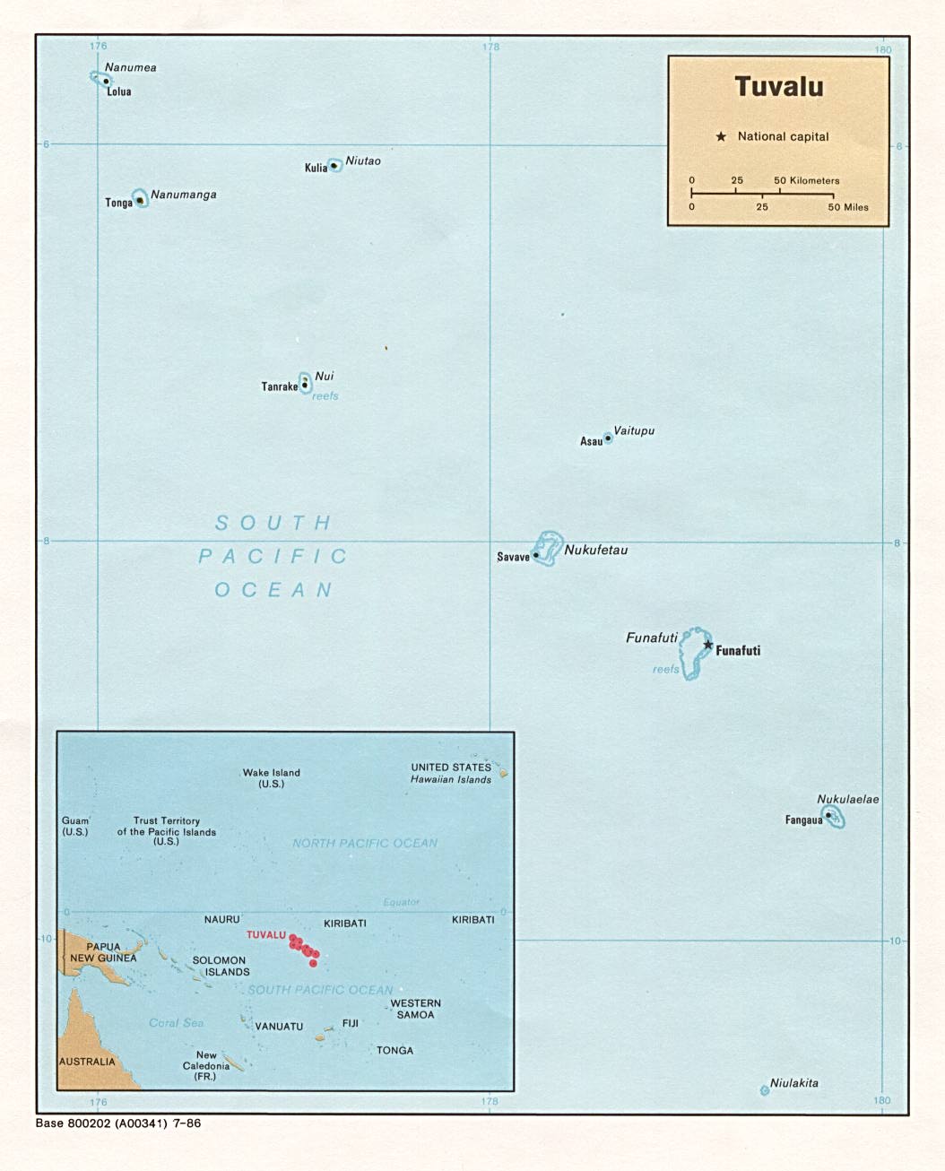
Country of Focus: Tuvalu
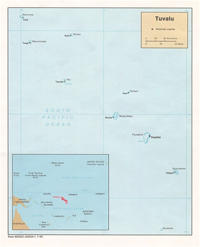
Tuvalu is a cluster of nine islands and islets that are located just south of the Equator in the southwestern Pacific Ocean (“Asia and Oceania,” 2011). Tuvalu is one of the smallest and most remote countries in the world ("Tuvalu," 2011). These islands lie in a 370 miles long chain extending over 500,000 square miles of ocean; the total land area is only 10 square miles (“Asia and Oceania,” 2011). This country has a tropical climate with very little seasonal variation; it is moderated by the easterly trade winds from March to November ("Tuvalu," 2011) Average temperatures are 86 °F (“Asia and Oceania,” 2011). Rainfall averages about 140 inches per year, with the most falling between November and February (“Asia and Oceania,” 2011). The surrounding seas are rich in both flora and fauna; however, land vegetation is limited. Agriculture is the principal occupation in this country, but only contributes 26% to the GDP (“Asia and Oceania,” 2011). Poor soil quality, consisting of sand and rock fragments, and uncertain rains limit the agriculture; coconuts are important cash crops (“Asia and Oceania,” 2011). There is no commercial mining and very little useful timber on the islands. Fishing is the main natural resource ("Tuvalu," 2011). In 2003, the population was estimated at 11,000 by the United Nations (“Asia and Oceania,” 2011). The population density is high, 52% of people live in urban areas, and about 6,000 people live on the most populated capital island of Funafuti (“Asia and Oceania,” 2011). Tuvaluans rapidly started following the Christian faith; today, approximately 91% of the population are Protestant members of the Church of Tuvalu (“Asia and Oceania,” 2011). Transportation is very inadequate in this country. There are only 12.1 miles of coral impacted roads in Funafuti for use by the islands few cars and trucks (“Asia and Oceania,” 2011). There are only two seaports and one grass stripped airport. The islands of Tuvalu are served by the one inter-island ferry.
References:
Asia and oceania. (2011). Encyclopedia of the Nations. Retrieved from http://www.nationsencyclopedia.com/Asia-and-Oceania/index.html
Australia landforms. (n.d.) Retrieved from http://www.worldatlas.com/webimage/countrys/oceania/aussnewld.htm
Christianity. (2004, March 17). Religion Facts. Retrieved from http://www.religionfacts.com/christianity/index.htm
Great artesian basin. (2011). Encyclopaedia Britannica. Retrieved from http://www.britannica.com/EBchecked/topic/242865/Great-Artesian-Basin
Great dividing range. (2008). New World Encyclopedia. Retrieved from http://www.newworldencyclopedia.org/entry/Great_Dividing_Range
Gulf of Carpentaria. (2011). Encyclopaedia Britannica. Retrieved from http://www.britannica.com/EBchecked/topic/96723/Gulf-of-Carpentaria
Oceania and food.(n.d.). Retrieved from http://world-food-and-wine.com/oceania-and-food
Przyborski, P. (2008). New zealand’s southern alps. Retrieved from http://visibleearth.nasa.gov/view_rec.php?id=1825
Pulsipher, L.M., & Pulsipher, A. (2008). World regional geography: global patterns, local lives (4th ed.).
New York, NY: W.H. Freeman and Company.
The University of Texas at Austin. University of Texas Libraries: Perry-Castaneda Library Map Collection. Oceania political map, 2001. Retrieved from http://www.lib.utexas.edu/maps/australia/oceania_pol01.jpg
The University of Texas at Austin. University of Texas Libraries: Perry-Castaneda Library Map Collection. Tuvalu political map, 1986. Retrieved from http://www.lib.utexas.edu/maps/islands_oceans_poles/tuvalu.jpg
Tuvalu. (2011, April 25). The World Factbook. Retrieved from https://www.cia.gov/library/publications/the-world-factbook/geos/tv.html
