NORTH AMERICA

Countries Present in this Region: 2
United States of America and Canada
Physical Features:
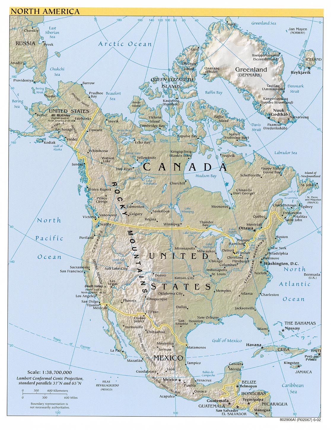
Along the west coast of Canada and the U.S. one will find the Rocky Mountains. These mountains run approximately 3000 miles from northwestern Alaska to central New Mexico. They also extend down into Mexico, where they are known as the Sierra Madre (Pulsipher & Pulsipher, 2008). The highest peak is in Colorado; this is known as Mt. Elbert with a height of 14,431 ft. They are found in between the Great Plains on the east and numerous basins and plateaus on the west. They were formed about 200 million years ago when the Pacific Plate and North American plate collided; this pushed up the mountains along the west coast (Pulsipher & Pulsipher, 2008). The Rockies were traveled by pioneers that wanted to go west. They mainly used the United States pass across the mountain, which was known as the South Pass, located in southwestern Wyoming; this was followed by the Oregon and Mormon trails. There are many outdoor activities to do here, including hunting, fishing/boating, camping, hiking, biking,
mountain climbing, or even just sight-seeing which attract
many tourists.
Along the eastern edge of North America lie the Appalachian Mountains. These mountains extend almost 2000 miles from Newfoundland and Labrador (Canadian province) in the northeast to Georgia in southeastern United States. The highest peak, Mt. Mitchell, is 6,684 feet. The majority of the mountain range is covered by deciduous forests; trees found here are hickories, maples, and oaks in which they are shipped to North Carolina furniture makers, and are also beautiful to view in the fall when the colors are changing. A large industry in this region is the tourism. Whether it is skiing when it snows, hiking along the Appalachian Natural Scenic trail which is the longest 200 mile foot path on the eastern coast, rafting, fishing, or balloon riding, there is something to do for everybody!
Located in northeastern North America, on the U.S. and Canada border, you will find the five Great Lakes (Lake Superior, Michigan, Huron, Erie, and Ontario). These lakes span, from west to east, more than 750 miles. Of these five lakes, Lake Superior is the largest in volume, coldest in temperature, and the deepest. The only one of these lakes entirely lying in the United States is Lake Michigan, the second largest (“Great Lakes,” 2008). The Great Lakes are the largest surface freshwater system in the world; they contain about 84% of this region’s fresh water and about 21% of the whole world’s supply of water (“Great Lakes,” 2008). This freshwater has provided water for human consumption, recreation, power, and even transportation.
The Grand Canyon is a gorge with relatively steep sides made by the Colorado River in the northern part of Arizona. It is a part of the Grand Canyon National Park, which is about 277 miles long, one mile deep, and ranges from 4 to 18 miles wide (“Grand canyon facts,” 2011). The Colorado River initially started cutting layers of rocks from the west, but gradually kept moving eastward. Because of heavy mineral deposits, people can see the beautiful colors of the canyon (bright red, brown, and orange). This place was first inhabited by Native Americans living within the caves; at this time, it was the pilgrim’s holy place. Tourists can go rafting on the Colorado River, take helicopter tours of the park, or even have a guided tour of the land via foot.
In southeastern California and southwestern Nevada is a deep and extremely dry 5000 square foot basin, known as Death Valley. It is 140 miles long and is bordered by the Panamint Range in the west and the Armargosa Range in the east. Summer air temperatures can reach 134 degrees and ground temperatures can reach 165 degrees; it is known has the hottest, driest place in North America as it receives less than 2 inches of rain annually. A protected region of Death Valley, Death Valley National Park, is a 3.4 million acre park was established in 1933 as a national monument and a national park in 1994 (“Death Valley,” 2008). Even though the environment is not very favorable, a variety of small animals and plants are found throughout Death Valley.
Climate:
Because North America is a large region, there are many temperature variations throughout the region. All climate zones, except for the tropical wet climate, are found here (Pulsipher & Pulsipher, 2008). With all of North America’s landforms, the various air masses contribute to all the different climates. In the northern part of this region, it is typically cooler and wetter compared to the southern part. The west coast is very rainy, receiving moderate to heavy rainfall, whereas the east side of the coastal mountain ranges are much drier (Pulsipher & Pulsipher, 2008) Because water is slower than land at heating up and cooling down, temperatures are warmer in the summer and cooler in the winter in the continental interior compared to coastal areas where the oceans and water help regulate the temperatures.
Resources:
Iron ore is a big resource in North America. Both the United States and Canada are major global producers; they are trailing behind the even bigger producers of Australia, China, Brazil, and India. Michigan, Minnesota, and Missouri are the primary iron ore producing states in the United States; Quebec is the main iron ore producer in Canada accounting for 99% of its production (“Iron Ore Mining,” 2011). In the United States, great deposits of iron ore are found in the Lake Superior region. The majority of iron ore that is mined is used for making steel. Steel is used for a variety of different things, such as manufacturing automobiles, trains and train tracks, and it is also used for construction. The Pacific Northwest region of North America is known for its logging. It provides a majority of the construction lumber used in North America, along with a growing amount of paper products (Pulsipher & Pulsipher, 2008). This lumber and different wood products are important exports to Asia. The northern parts of Quebec, near the Hudson Bay, are also rich in timber (Pulsipher & Pulsipher, 2008). Wheat is another important resource of North America. Wheat is a dominant crop in what is known as the Wheat Belt, a part of the Great Plains in North America. This belt runs north to sound for about 1,500 miles from central Alberta, Canada to central Texas (“Wheat Belt,” 2011).
Environmental Issues:
There are various environmental issues/concerns in this region. One issue is the loss of habitats for plants and animals. Today, extinction is a concern, especially for many plants and animals in this region because of the human population destroying the environment where these plants & animals live. In 2003, the United States had the highest percentage of the world’s threat of extinction of plant and animals of all the countries in the world (Pulsipher & Pulsipher, 2008). Enormous amounts of forests and grasslands were cleared for farms as North America was in development. Housing, roads, and businesses are taking over what is left of the natural land. Because this natural land is being eliminated, plants and animals in this region have small territories to live in; many have either completely died or have been replaced by non-indigenous species (Pulsipher & Pulsipher, 2008). It is believed by biogeographers that the complete extinction of species, or even the declining amounts, is going to have negative effects on life. Destroying wetlands is an important issue as these places are where many birds and aquatic species reproduce. Another issue is that of air pollution. According to the text World Regional Geography: Global Patterns, Local Lives, this region produces 26% of the greenhouse gases released globally by humans and their activities. These greenhouse gases can lead to global warming and different forms of air pollution. North America uses a lot of fossil fuels. Nitrogen dioxide changes in the air to a form of gas called nitric acid and also organic nitrates that are toxic. This comes from the burning of fossil fuels by automobiles and power plants. This burning of fossil fuels can also lead to acid rain. This acidic rain can kill trees, hurt fish and wildlife, and corrode buildings and other structures (Pulsipher & Pulsipher, 2008). Acid rain affects the eastern half of North America; the large population and large industries of the U.S. helps account for most of this acid rain. Smog (smoke and fog) covers many cities in this region and can lead to many different types of health problems.
Population Patterns:
There are many different races and ethnicities in this region. This ranges from Europeans to Native Americans, African Americans, Hispanics, to Asians. Humans first came to North America from northeastern Asia during the ice age, between 14,000 to 25,000 years ago (Pulsipher & Pulsipher, 2008). European immigrants have settled in North America since the early 1600s. British colonies were established in the early 1700s along the Atlantic coast. In 1492, there were about 18 million Native Americans in North America; by 1907, only 400,000 remained because such diseases as measles and mumps killed them off because they hadn’t acquired immunity like the Europeans and Africans (Pulsipher & Pulsipher, 2008). Starting in 1619, African slave workers were brought into this region to secure a stable labor force. In 1861, the start of the Civil War, slaves made up about one third of the population throughout the south. In 2006, over 300 million people were living in the United States with the majority of people in the northeastern part close to the Canada border (Pulsipher & Pulsipher, 2008).Today, more than 332 million people live in this region. The majority of Canadians live in southeastern Canada and the Great Lakes region near the border because of the rugged terrain and bitterly cold temperatures. There is also poor soil around the Canadian Shield. Along the Pacific coast, the population density is high. The western half of North America is less densely populated due to it being mountainous and lacking rain fall. Most people tend to live in big cities; there are large populations in the northeast and west coast. Big cities have better opportunities. In the U.S., 80% of people live in areas of 50,000 or more people and 60% of Canada’s population lives in these bigger areas. In the 20th century, there was a trend of the U.S. population moving from the northeast to the south and west (Pulsipher & Pulsipher, 2008). Americans are very mobile; it is estimated that one fifth of the population moves due to changing jobs, changing schools, or going to a warmer climate (Pulsipher & Pulsipher, 2008). Immigrants are coming into North America at about 5000 per day. With this increase, the Population Reference Bureau estimates the population in 2050 hit 420 million (Pulsipher & Pulsipher, 2008).
Role of Gender:
In earlier years, the workforce consisted of mainly men. Today, North American women make up about 50% of the labor force (Pulsipher & Pulsipher, 2008). It is said that most women are working under male managers. Women business owners in this region are starting almost half of all the new businesses; however, they tend to be smaller and not as financially secure as men entrepreneurs because of the fact that it is harder for women to obtain loans and large contracts (Pulsipher & Pulsipher, 2008). In the U.S., men hold 70% of the governments and business’s top executive positions (Pulsipher & Pulsipher, 2008). On average, female workers make 38 cents per hour less than males. However, in Canada, women earn slightly more than men. In both countries, women tend to put more time in at work. Estimations reveal that the poverty rate would be reduced by half if men and women earned the same wages (Pulsipher & Pulsipher, 2008). In today’s age, the nuclear family, consisting of the married mother and father and their children, is more common than the extended families. Because both genders were working, there wasn’t much family time; their social life consisted of work (Pulsipher & Pulsipher, 2008). This decrease in marital bonding and unhappy marriages caused divorce rates to sky rocket. More and more Americans are living alone in today’s world because of divorce or death of their once nuclear family. Single parent families are also increasing; the majority of these households are young females and the responsibilities can be very stressful, especially the economic aspect.
Religions:
People in North America have the freedom to choice if they want to follow a religion or not. If they want to, they have the choice of which religion to follow. North American’s main religious group is Christianity because of the large number of early immigrants to North America brought Christianity with them. There are many variations to Christianity ranging from Roman Catholicism to Lutheranism to Baptists. Each of these are linked with where the immigrants settled and their religions back home. The two religions we will describe briefly are Lutheran and Roman Catholics. Lutheranism is mainly found in Minnesota and the eastern portions of North and South Dakota; these are the places where the Scandinavians have settled. Some Lutherans use the Book of Concord, an authority of beliefs and practices. Others use the Holy Scripture for their beliefs and practices. This group practices infant and adult baptism which cleanses the body from sin and gives them an everlasting life. In most Lutheran churches, it is believes that homosexuality opposes God’s word and will. Roman Catholicism is mainly found where Hispanics, French, Irish, and Italian people settled; these places are found in southwest and northeast United States, along with Quebec. Unlike earlier times, Roman Catholics today have distinct beliefs, practices, and traditions from those of other Christians. These Catholics believe that the pope has special authority, Purgatory is a place of purification before entering Heaven in the afterlife, and the Bible’s inspiration. They observe seven religious beliefs/sacraments. They usually celebrate Eucharist weekly, and use rosary breads in prayer. According to the text World Regional Geography: Global Patterns, Local Lives, a “majority of Americans favor the continued separation of church and state” (Pulsipher & Pulsipher, 2008). They also favor their personal choice in belief, along with other things. Both topics, religion and politics, can be very controversial. This is why they remain two separate categories (Pulsipher & Pulsipher, 2008).
Transportation:
With the development of large quantities of automobiles in the 1920’s, less railroad tracks existed between 1930 and 1980 since automobiles could travel faster than train. The completed Interstate Highway system in 1990 brought advantages to deliveries; they were able to deliver faster and cheaper. (Pulsipher & Pulsipher, 2008). This high-speed network highway system was connected to all of the local roads, also. Shipping via ships is still used throughout lakes and rivers also. Air transportation after World War II became huge. It is used to move goods, for personal travel, and also business travel (Pulsipher & Pulsipher, 2008)
Agriculture:
North America has a large food supply, producing food for both consumers in the region, and foreign consumers. North America has agricultural possibilities throughout most of the region, except for northern Canada and Alaska due to cold, and between the Great Plains and the Pacific coastal zone because of the dry mountain region. Agricultural exports were huge for the North American economy in earlier years. Today, exports are only 20-30% of the economy as most income comes from inner region consumers (Pulsipher & Pulsipher, 2008). The economic role of agriculture only accounts for 1.7% of the region’s GDP (gross domestic product). Today, less than 2% of the North American workforce is employed in the agriculture setting as farms need fewer workers because of new technology(Pulsipher & Pulsipher, 2008).Corporate farms, which have advantages over small farms, have shrunk local economies and created social problems (Pulsipher & Pulsipher, 2008). They engage in farming, research and marketing, processing, and transport and delivery, providing various foods at relatively low prices to customers in this region. Because of this, small farms have a hard time competing because of the need for large quantities of accessible monies.
Cuisine:
Many different types of foods are found here in North America. Most cuisines are influenced by English and French cooking. With the broad cultures here, you can find Chinese, Japanese, Mexican, and even Italian cooking and restaurants. Also, convenience and fast food restaurants are very popular, as you can grab food on the fly! In general, you can eat a little bit of everything in this region. You could be eating Mexican fried rice, clam chowder, or barbequed foods. There may even be a mixture of foods from different cultures. Also, hunting and fishing are a very popular way to get food. Many people prefer wild game over store bought meat. In this region, people tend to eat until they are full!
United States of America and Canada
Physical Features:
Along the west coast of Canada and the U.S. one will find the Rocky Mountains. These mountains run approximately 3000 miles from northwestern Alaska to central New Mexico. They also extend down into Mexico, where they are known as the Sierra Madre (Pulsipher & Pulsipher, 2008). The highest peak is in Colorado; this is known as Mt. Elbert with a height of 14,431 ft. They are found in between the Great Plains on the east and numerous basins and plateaus on the west. They were formed about 200 million years ago when the Pacific Plate and North American plate collided; this pushed up the mountains along the west coast (Pulsipher & Pulsipher, 2008). The Rockies were traveled by pioneers that wanted to go west. They mainly used the United States pass across the mountain, which was known as the South Pass, located in southwestern Wyoming; this was followed by the Oregon and Mormon trails. There are many outdoor activities to do here, including hunting, fishing/boating, camping, hiking, biking,
mountain climbing, or even just sight-seeing which attract
many tourists.
Along the eastern edge of North America lie the Appalachian Mountains. These mountains extend almost 2000 miles from Newfoundland and Labrador (Canadian province) in the northeast to Georgia in southeastern United States. The highest peak, Mt. Mitchell, is 6,684 feet. The majority of the mountain range is covered by deciduous forests; trees found here are hickories, maples, and oaks in which they are shipped to North Carolina furniture makers, and are also beautiful to view in the fall when the colors are changing. A large industry in this region is the tourism. Whether it is skiing when it snows, hiking along the Appalachian Natural Scenic trail which is the longest 200 mile foot path on the eastern coast, rafting, fishing, or balloon riding, there is something to do for everybody!
Located in northeastern North America, on the U.S. and Canada border, you will find the five Great Lakes (Lake Superior, Michigan, Huron, Erie, and Ontario). These lakes span, from west to east, more than 750 miles. Of these five lakes, Lake Superior is the largest in volume, coldest in temperature, and the deepest. The only one of these lakes entirely lying in the United States is Lake Michigan, the second largest (“Great Lakes,” 2008). The Great Lakes are the largest surface freshwater system in the world; they contain about 84% of this region’s fresh water and about 21% of the whole world’s supply of water (“Great Lakes,” 2008). This freshwater has provided water for human consumption, recreation, power, and even transportation.
The Grand Canyon is a gorge with relatively steep sides made by the Colorado River in the northern part of Arizona. It is a part of the Grand Canyon National Park, which is about 277 miles long, one mile deep, and ranges from 4 to 18 miles wide (“Grand canyon facts,” 2011). The Colorado River initially started cutting layers of rocks from the west, but gradually kept moving eastward. Because of heavy mineral deposits, people can see the beautiful colors of the canyon (bright red, brown, and orange). This place was first inhabited by Native Americans living within the caves; at this time, it was the pilgrim’s holy place. Tourists can go rafting on the Colorado River, take helicopter tours of the park, or even have a guided tour of the land via foot.
In southeastern California and southwestern Nevada is a deep and extremely dry 5000 square foot basin, known as Death Valley. It is 140 miles long and is bordered by the Panamint Range in the west and the Armargosa Range in the east. Summer air temperatures can reach 134 degrees and ground temperatures can reach 165 degrees; it is known has the hottest, driest place in North America as it receives less than 2 inches of rain annually. A protected region of Death Valley, Death Valley National Park, is a 3.4 million acre park was established in 1933 as a national monument and a national park in 1994 (“Death Valley,” 2008). Even though the environment is not very favorable, a variety of small animals and plants are found throughout Death Valley.
Climate:
Because North America is a large region, there are many temperature variations throughout the region. All climate zones, except for the tropical wet climate, are found here (Pulsipher & Pulsipher, 2008). With all of North America’s landforms, the various air masses contribute to all the different climates. In the northern part of this region, it is typically cooler and wetter compared to the southern part. The west coast is very rainy, receiving moderate to heavy rainfall, whereas the east side of the coastal mountain ranges are much drier (Pulsipher & Pulsipher, 2008) Because water is slower than land at heating up and cooling down, temperatures are warmer in the summer and cooler in the winter in the continental interior compared to coastal areas where the oceans and water help regulate the temperatures.
Resources:
Iron ore is a big resource in North America. Both the United States and Canada are major global producers; they are trailing behind the even bigger producers of Australia, China, Brazil, and India. Michigan, Minnesota, and Missouri are the primary iron ore producing states in the United States; Quebec is the main iron ore producer in Canada accounting for 99% of its production (“Iron Ore Mining,” 2011). In the United States, great deposits of iron ore are found in the Lake Superior region. The majority of iron ore that is mined is used for making steel. Steel is used for a variety of different things, such as manufacturing automobiles, trains and train tracks, and it is also used for construction. The Pacific Northwest region of North America is known for its logging. It provides a majority of the construction lumber used in North America, along with a growing amount of paper products (Pulsipher & Pulsipher, 2008). This lumber and different wood products are important exports to Asia. The northern parts of Quebec, near the Hudson Bay, are also rich in timber (Pulsipher & Pulsipher, 2008). Wheat is another important resource of North America. Wheat is a dominant crop in what is known as the Wheat Belt, a part of the Great Plains in North America. This belt runs north to sound for about 1,500 miles from central Alberta, Canada to central Texas (“Wheat Belt,” 2011).
Environmental Issues:
There are various environmental issues/concerns in this region. One issue is the loss of habitats for plants and animals. Today, extinction is a concern, especially for many plants and animals in this region because of the human population destroying the environment where these plants & animals live. In 2003, the United States had the highest percentage of the world’s threat of extinction of plant and animals of all the countries in the world (Pulsipher & Pulsipher, 2008). Enormous amounts of forests and grasslands were cleared for farms as North America was in development. Housing, roads, and businesses are taking over what is left of the natural land. Because this natural land is being eliminated, plants and animals in this region have small territories to live in; many have either completely died or have been replaced by non-indigenous species (Pulsipher & Pulsipher, 2008). It is believed by biogeographers that the complete extinction of species, or even the declining amounts, is going to have negative effects on life. Destroying wetlands is an important issue as these places are where many birds and aquatic species reproduce. Another issue is that of air pollution. According to the text World Regional Geography: Global Patterns, Local Lives, this region produces 26% of the greenhouse gases released globally by humans and their activities. These greenhouse gases can lead to global warming and different forms of air pollution. North America uses a lot of fossil fuels. Nitrogen dioxide changes in the air to a form of gas called nitric acid and also organic nitrates that are toxic. This comes from the burning of fossil fuels by automobiles and power plants. This burning of fossil fuels can also lead to acid rain. This acidic rain can kill trees, hurt fish and wildlife, and corrode buildings and other structures (Pulsipher & Pulsipher, 2008). Acid rain affects the eastern half of North America; the large population and large industries of the U.S. helps account for most of this acid rain. Smog (smoke and fog) covers many cities in this region and can lead to many different types of health problems.
Population Patterns:
There are many different races and ethnicities in this region. This ranges from Europeans to Native Americans, African Americans, Hispanics, to Asians. Humans first came to North America from northeastern Asia during the ice age, between 14,000 to 25,000 years ago (Pulsipher & Pulsipher, 2008). European immigrants have settled in North America since the early 1600s. British colonies were established in the early 1700s along the Atlantic coast. In 1492, there were about 18 million Native Americans in North America; by 1907, only 400,000 remained because such diseases as measles and mumps killed them off because they hadn’t acquired immunity like the Europeans and Africans (Pulsipher & Pulsipher, 2008). Starting in 1619, African slave workers were brought into this region to secure a stable labor force. In 1861, the start of the Civil War, slaves made up about one third of the population throughout the south. In 2006, over 300 million people were living in the United States with the majority of people in the northeastern part close to the Canada border (Pulsipher & Pulsipher, 2008).Today, more than 332 million people live in this region. The majority of Canadians live in southeastern Canada and the Great Lakes region near the border because of the rugged terrain and bitterly cold temperatures. There is also poor soil around the Canadian Shield. Along the Pacific coast, the population density is high. The western half of North America is less densely populated due to it being mountainous and lacking rain fall. Most people tend to live in big cities; there are large populations in the northeast and west coast. Big cities have better opportunities. In the U.S., 80% of people live in areas of 50,000 or more people and 60% of Canada’s population lives in these bigger areas. In the 20th century, there was a trend of the U.S. population moving from the northeast to the south and west (Pulsipher & Pulsipher, 2008). Americans are very mobile; it is estimated that one fifth of the population moves due to changing jobs, changing schools, or going to a warmer climate (Pulsipher & Pulsipher, 2008). Immigrants are coming into North America at about 5000 per day. With this increase, the Population Reference Bureau estimates the population in 2050 hit 420 million (Pulsipher & Pulsipher, 2008).
Role of Gender:
In earlier years, the workforce consisted of mainly men. Today, North American women make up about 50% of the labor force (Pulsipher & Pulsipher, 2008). It is said that most women are working under male managers. Women business owners in this region are starting almost half of all the new businesses; however, they tend to be smaller and not as financially secure as men entrepreneurs because of the fact that it is harder for women to obtain loans and large contracts (Pulsipher & Pulsipher, 2008). In the U.S., men hold 70% of the governments and business’s top executive positions (Pulsipher & Pulsipher, 2008). On average, female workers make 38 cents per hour less than males. However, in Canada, women earn slightly more than men. In both countries, women tend to put more time in at work. Estimations reveal that the poverty rate would be reduced by half if men and women earned the same wages (Pulsipher & Pulsipher, 2008). In today’s age, the nuclear family, consisting of the married mother and father and their children, is more common than the extended families. Because both genders were working, there wasn’t much family time; their social life consisted of work (Pulsipher & Pulsipher, 2008). This decrease in marital bonding and unhappy marriages caused divorce rates to sky rocket. More and more Americans are living alone in today’s world because of divorce or death of their once nuclear family. Single parent families are also increasing; the majority of these households are young females and the responsibilities can be very stressful, especially the economic aspect.
Religions:
People in North America have the freedom to choice if they want to follow a religion or not. If they want to, they have the choice of which religion to follow. North American’s main religious group is Christianity because of the large number of early immigrants to North America brought Christianity with them. There are many variations to Christianity ranging from Roman Catholicism to Lutheranism to Baptists. Each of these are linked with where the immigrants settled and their religions back home. The two religions we will describe briefly are Lutheran and Roman Catholics. Lutheranism is mainly found in Minnesota and the eastern portions of North and South Dakota; these are the places where the Scandinavians have settled. Some Lutherans use the Book of Concord, an authority of beliefs and practices. Others use the Holy Scripture for their beliefs and practices. This group practices infant and adult baptism which cleanses the body from sin and gives them an everlasting life. In most Lutheran churches, it is believes that homosexuality opposes God’s word and will. Roman Catholicism is mainly found where Hispanics, French, Irish, and Italian people settled; these places are found in southwest and northeast United States, along with Quebec. Unlike earlier times, Roman Catholics today have distinct beliefs, practices, and traditions from those of other Christians. These Catholics believe that the pope has special authority, Purgatory is a place of purification before entering Heaven in the afterlife, and the Bible’s inspiration. They observe seven religious beliefs/sacraments. They usually celebrate Eucharist weekly, and use rosary breads in prayer. According to the text World Regional Geography: Global Patterns, Local Lives, a “majority of Americans favor the continued separation of church and state” (Pulsipher & Pulsipher, 2008). They also favor their personal choice in belief, along with other things. Both topics, religion and politics, can be very controversial. This is why they remain two separate categories (Pulsipher & Pulsipher, 2008).
Transportation:
With the development of large quantities of automobiles in the 1920’s, less railroad tracks existed between 1930 and 1980 since automobiles could travel faster than train. The completed Interstate Highway system in 1990 brought advantages to deliveries; they were able to deliver faster and cheaper. (Pulsipher & Pulsipher, 2008). This high-speed network highway system was connected to all of the local roads, also. Shipping via ships is still used throughout lakes and rivers also. Air transportation after World War II became huge. It is used to move goods, for personal travel, and also business travel (Pulsipher & Pulsipher, 2008)
Agriculture:
North America has a large food supply, producing food for both consumers in the region, and foreign consumers. North America has agricultural possibilities throughout most of the region, except for northern Canada and Alaska due to cold, and between the Great Plains and the Pacific coastal zone because of the dry mountain region. Agricultural exports were huge for the North American economy in earlier years. Today, exports are only 20-30% of the economy as most income comes from inner region consumers (Pulsipher & Pulsipher, 2008). The economic role of agriculture only accounts for 1.7% of the region’s GDP (gross domestic product). Today, less than 2% of the North American workforce is employed in the agriculture setting as farms need fewer workers because of new technology(Pulsipher & Pulsipher, 2008).Corporate farms, which have advantages over small farms, have shrunk local economies and created social problems (Pulsipher & Pulsipher, 2008). They engage in farming, research and marketing, processing, and transport and delivery, providing various foods at relatively low prices to customers in this region. Because of this, small farms have a hard time competing because of the need for large quantities of accessible monies.
Cuisine:
Many different types of foods are found here in North America. Most cuisines are influenced by English and French cooking. With the broad cultures here, you can find Chinese, Japanese, Mexican, and even Italian cooking and restaurants. Also, convenience and fast food restaurants are very popular, as you can grab food on the fly! In general, you can eat a little bit of everything in this region. You could be eating Mexican fried rice, clam chowder, or barbequed foods. There may even be a mixture of foods from different cultures. Also, hunting and fishing are a very popular way to get food. Many people prefer wild game over store bought meat. In this region, people tend to eat until they are full!
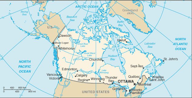
Country of Focus: Canada
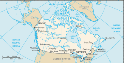
The United States has a population that is ten times that of Canada. This may seem odd, since both the U.S. and Canada take up equal space. Canada is a cold country, and therefore it is not densely populated. Although Canada is known for its great productivity, the United States economy is more than ten times that of Canada. Because of Canada’s smaller economy, they are most dependent on the United States; it is not the United States that is dependent on Canada .Foreign policy in Canada is all about keeping its relationship with the United States. However, the U.S. is focused on different countries, and Canada isn’t one of them. The health care coverage between Canada and the United States has its differences also. 100% of Canada’s people are covered in the health care system unlike the 60% covered in the U.S (Pulsipher & Pulsipher, 2008). This leaves 40% of the U.S.’s population uninsured. The United States has higher medication costs than Canada.
References:
Barritt, K., & Pardmore, G. (n.d.). A virtual tour of the appalachian mountains. Retrieved from http://www.ncsu.edu/midlink/appalachian.mt./cover.app.html
Death Valley.(2008). The Columbia Encyclopedia, Sixth Edition. 2008. Retrieved from http://www.encyclopedia.com/topic/Death_Valley.aspx#1
Grand canyon facts, history & location. (2011). Retrieved from http://famouswonders.com/grand-canyon-in-arizona/
Great lakes. (Last updated 2008, Oct 3). U.S. Environmental Protection Agency. Retrieved from http://www.epa.gov/glnpo/basicinfo.html
Iron ore mining in north america. (Last modified 2011, Feb 10). MBendi Information Services. Retrieved from http://www.mbendi.com/indy/ming/iron/am/p0005.htm#5
Iron ore. (n.d.). Minerals Zone: World Mineral Exchange. Retrieved from http://www.mineralszone.com/minerals/iron-ore.html
Lutheranism. (n.d.). Retrieved from http://www.religionfacts.com/christianity/denominations/lutheranism.htm
North american cuisine and recipes. (2011).Retrieved from http://www.whats4eats.com/north-america
North america: population patterns. (2010).Retrieved from http://www.authorstream.com/Presentation/mrjtoombs-154436-north-america-population-patterns-poppatnamer-education-ppt-powerpoint/
Pulsipher, L.M., & Pulsipher, A. (2008). World regional geography: global patterns, local lives (4th ed.).
New York, NY: W.H. Freeman and Company.
Rocky mountains. (2008). The Columbia Encyclopedia, Sixth Edition. Retrieved from
http://www.encyclopedia.com/topic/Rocky_Mountains.aspx
Roman catholicism. (n.d.). Retrieved from http://www.religionfacts.com/christianity/denominations/catholicism.htm
The University of Texas at Austin. University of Texas Libraries: Perry-Castaneda Library Map Collection. Retrieved from http://www.lib.utexas.edu/maps/americas/north_america_ref02.jpg
The University of Texas at Austin. University of Texas Libraries: Perry-Castaneda Library Map Collection. Retrieved from http://www.lib.utexas.edu/maps/cia10/canada_sm_2010.gif
Wheat belt. (2011).Encylopaedia Britannica. Retrieved from http://www.britannica.com/EBchecked/topic/641596/Wheat-Belt
